


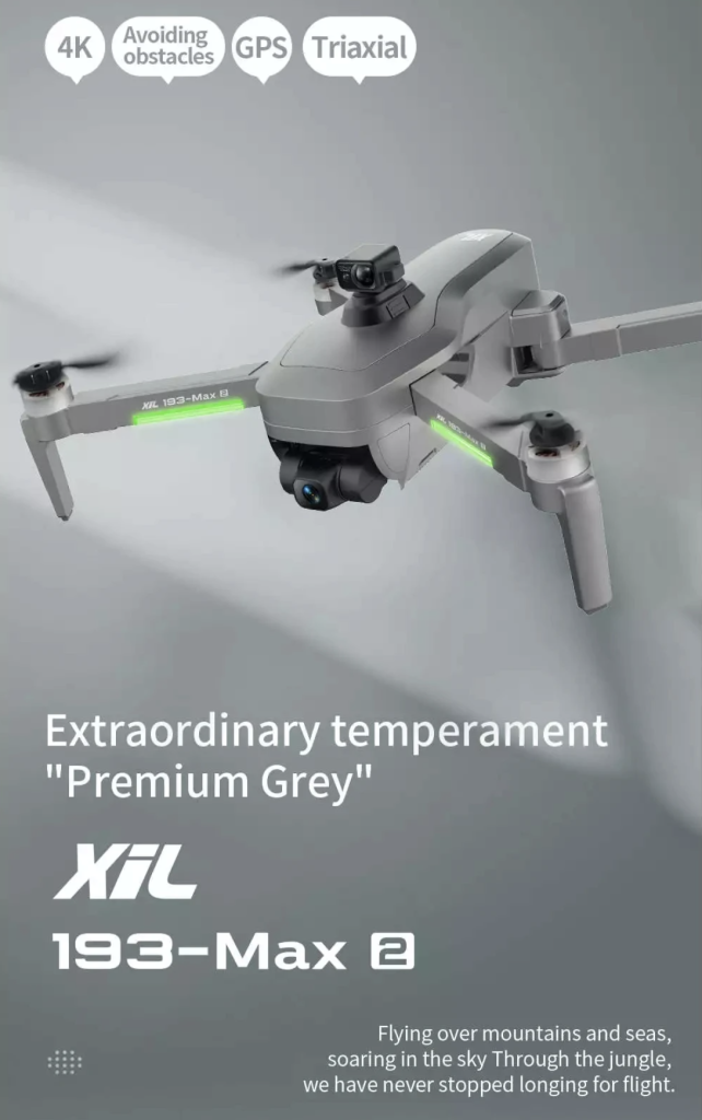
1. Three-Axis Gimbal, EIS anti shake auto-stabilizing platform drone with obstacle avoidance.
2.Brushless motors 1806, smaller noise and more powerful
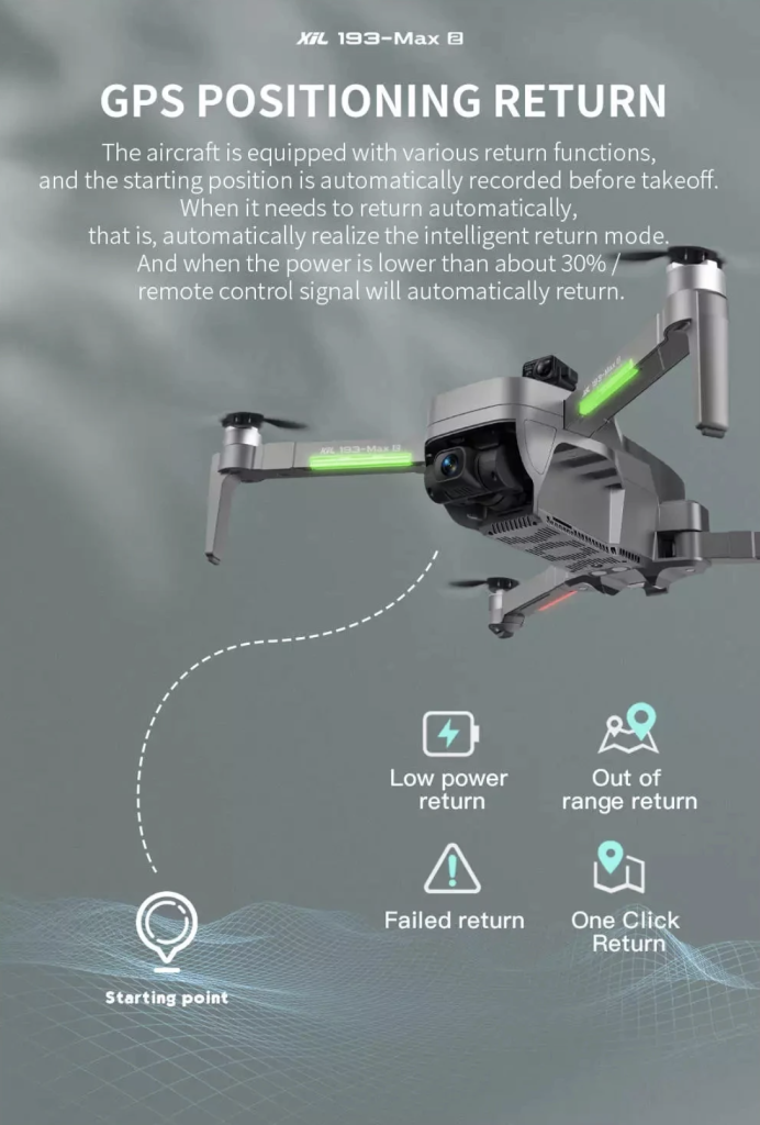
3.GPS global location
4.Optical flow altitude hold when flying in door
5.Taking photos/videos by gesture control (3 seconds delay)
6.Fix point surround flying and video taking
7.Smart follow me , or GPS follow
8.When low power or losing signal it will fly back to the place it took off
9.Headless mode flying
10.Camera lens electrical adjustment 110 degree
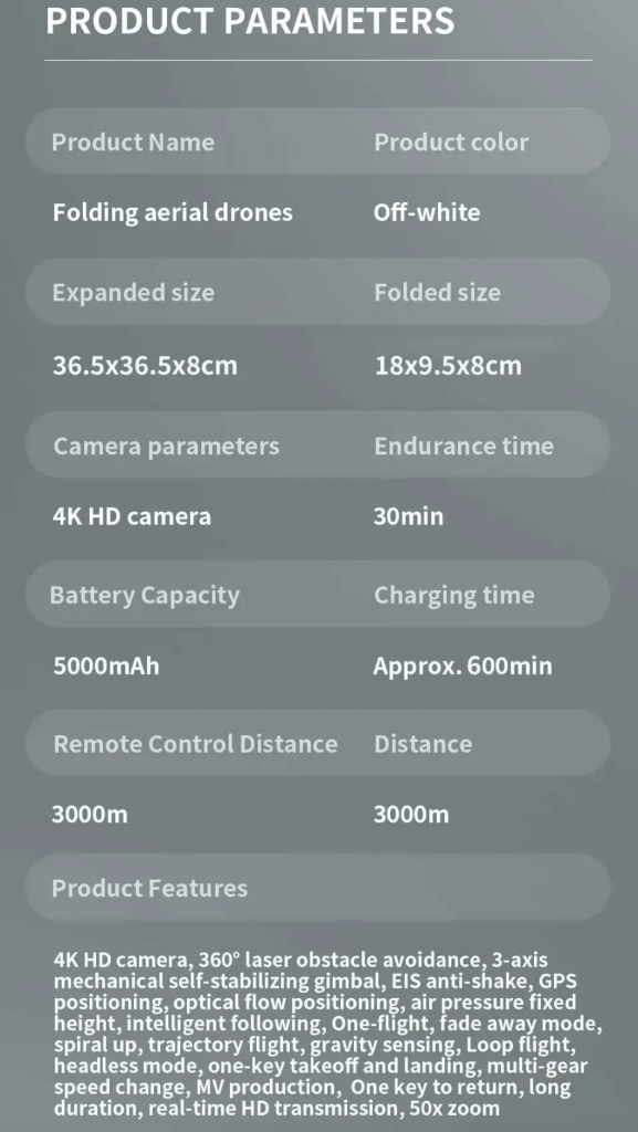
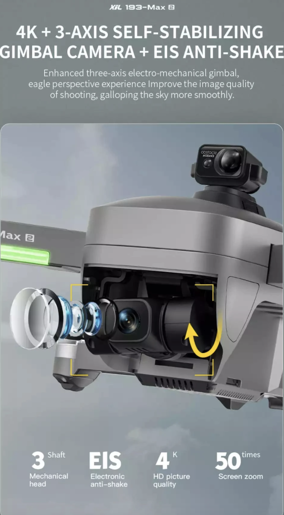
Camera:
4K Ultra camera
Resolution of pictures taken: 4096×2160 P
Resolution of videos taken: 4096×2160 P
Videos 60 frame per second
Maximum Transmission Frame Rate: 720P@30FPS
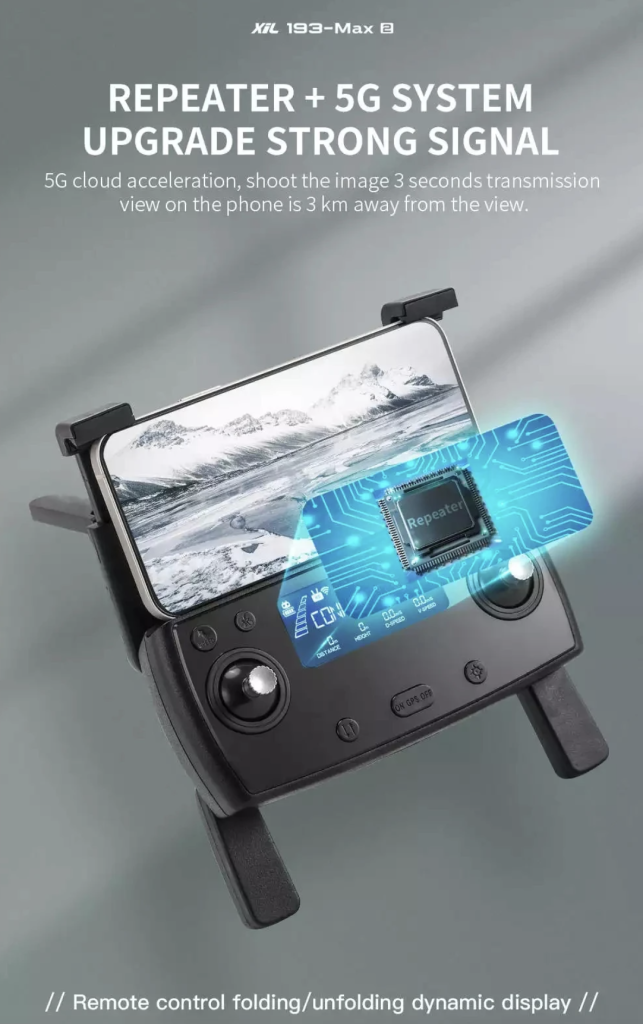
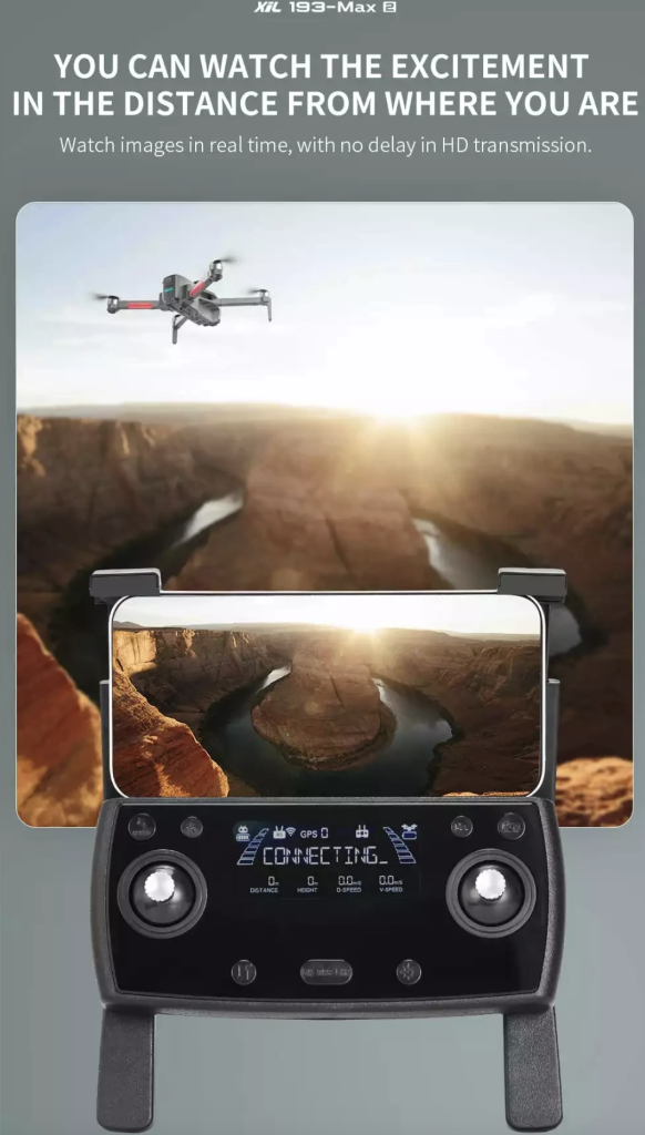
Video Transmission System: 5G WiFi
Image Transmission Range: 3000m
Lens Angle: 130°
Aperture: f/2.0
Focal Length: 2.8mm
Sensor: 1/3 inch CMOS
Shutter speed: 1/30s-1/10000s
ISO range:100 – 3200 for Video/Photo
Camera Adjustable Angle: 0° to -110°
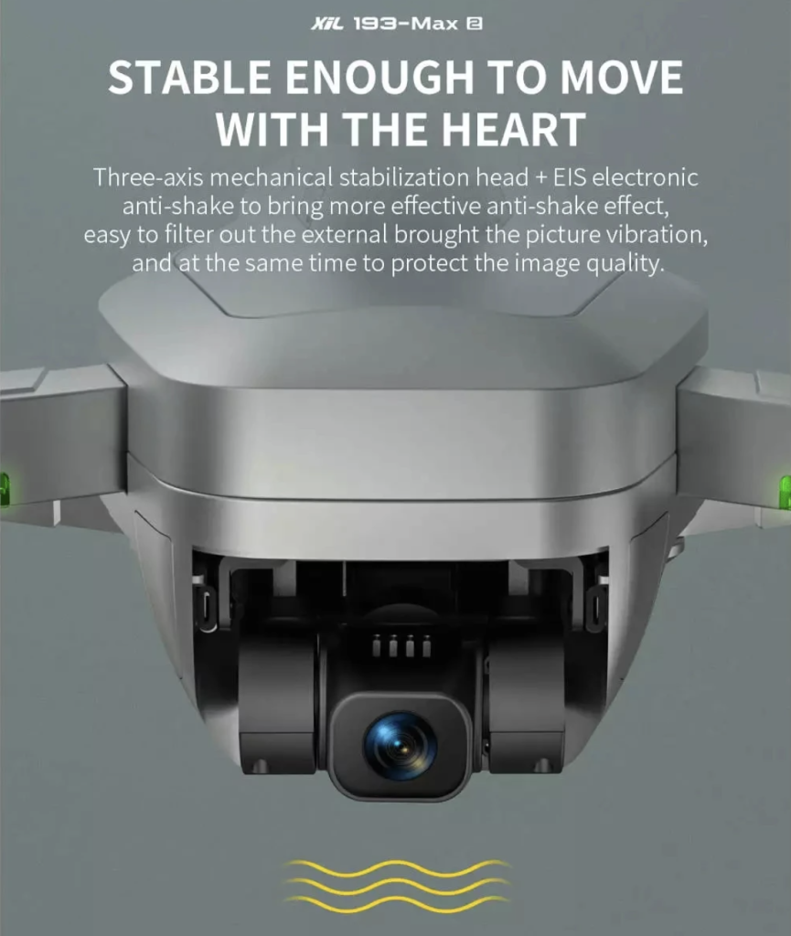
Gimbal: 3-axis Gimbal
Supported SD Cards: Micro SD Card(Not including)
Functions:
1. GPS returns to the take-off point with one key, low power return, no signal.
2. GPS smart follow: After the aircraft is connected to the GPS, open the APP follow function, and the aircraft will move with the mobile phone.
Image follow: 1-5m from the aircraft to identify the subject and automatically follow the flight.
3. Gesture shooting recognition: within 1-5m from the aircraft, face the camera to make a photo gesture/camera gesture.
4. Multi-point flight planning for the route: The aircraft will fly autonomously according to the preset route, and the player will focus on shooting.
5. Fixed-point surround: find the center of the circle, and then move the desired circle radius through the joystick.
6. Aircraft retrieval function: Tap the GPS signal icon 3 times to open the map interface, the map displays the last distance, latitude and longitude of the aircraft.
7. MV function: filters, video effects, adding background music, picture/video sharing
8. Obstacle avoidance function: The obstacle avoidance device detects whether there are obstacles ahead through the 120° fan-shaped scanning in front of the laser, and the remote control will sound an alarm if the obstacle is detected within 20 meters, and the drone cannot move forward.
![]()